Honolulu TOD Transit Corridor
Timeline
Sector
Service
Location
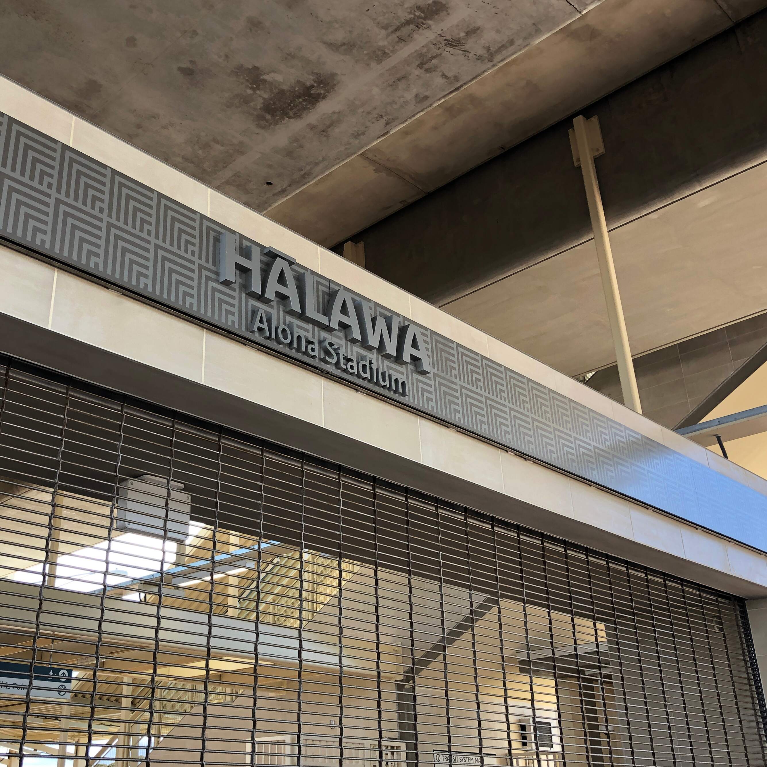
In 2018, Honolulu's Department of Planning and Permitting (DPP) partnered with Two Twelve, PBR Hawai‘i, and TransitScreen to develop a comprehensive wayfinding master plan. The aim is to support the transit-oriented development (TOD) goal of creating a more sustainable future for O‘ahu by increasing the number of people who live, work, and visit within a short walk of transit.
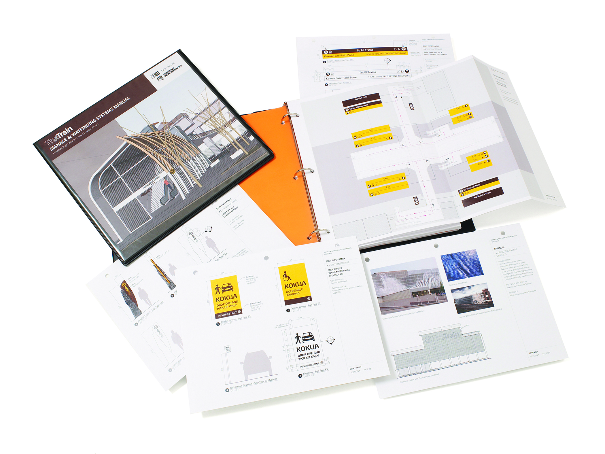
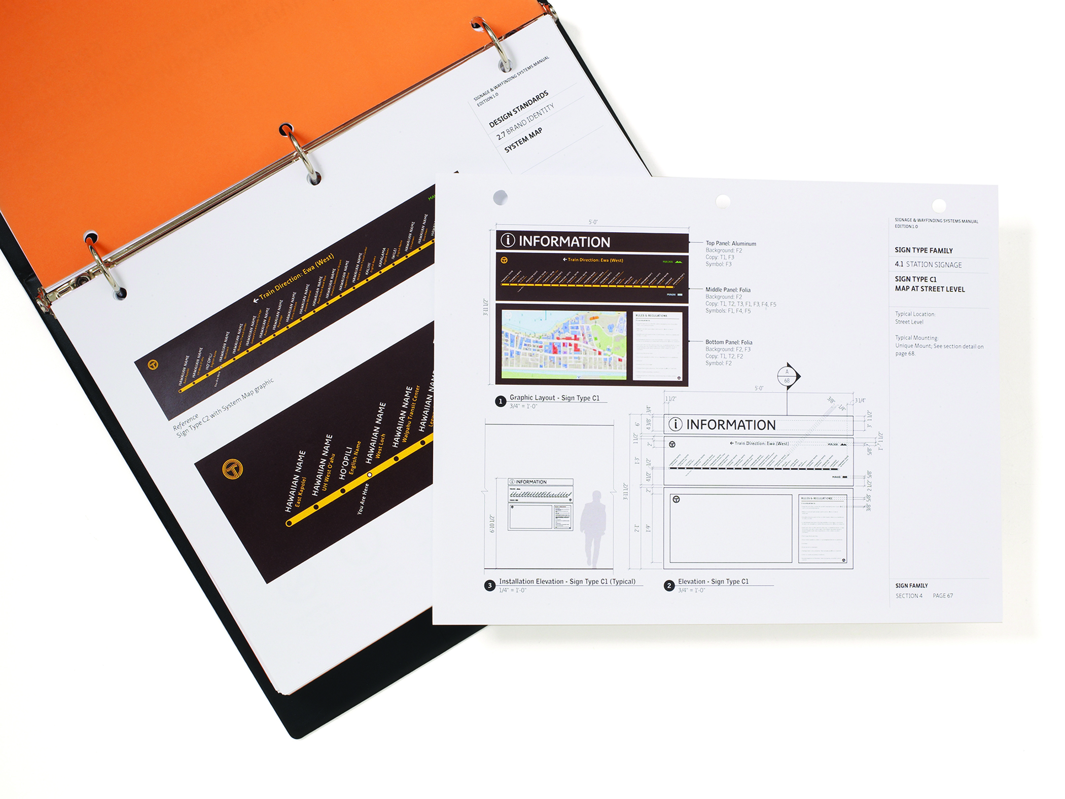
The Wayfinding Master Plan spans multiple phases, focusing on detailed design and planning. We carefully examined various elements such as form, colors, materials, typography, iconography, and content hierarchy to establish a cohesive aesthetic and information structure for the wayfinding signs. This aesthetic reflects a blend of sustainable principles and Honolulu's cultural identity. Consulting with Hawaiian cultural expert Ramsay Tam, we developed a culturally resonant color palette. Additionally, we created a uniform neighborhood map style applicable across diverse typologies, ensuring a streamlined and user-friendly system. Crucially, the plan considers the unique rider experience during the phased opening of the rail line, and the opportunities for pedestrian wayfinding to contribute to both increased ridership and the development of transit-enhanced neighborhoods.
.jpeg)